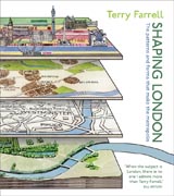
In this wholly new and dynamic view of London, renowned architect Sir Terry Farrell joins up the dots and creates new connections between Londons past, present and future. By looking beyond the contribution of individual buildings tothe city, Farrell creates a much larger and more exciting canvas, charting how the capitals messy and complex shape has been hewn out of a series of layers- natural and manmade. So The Thames and the natural landscape get as much attention as the railway infrastructure, the tube, the roads and the canals. This provides a whole series of revelations that allow us to see the city afresh:How might the natural bends in the river have impacted where and what was built? How have the Thames shores shifted over time? How have the Thames tributaries affected historic boundaries and development, played out in the Great Estates of Mayfair and Marylebone? How is the Roman plan for the city of London still discernible in The Citys street patterns? Illustrated with maps, archive photographs and paintings, as well as original sketches by Farrell, the book provides a vibrant and intriguing collage of Londons patterns and its history. It gives an account that stretches from the verdant banks of the Thames at Richmond and Kew to London Docklands and the heavily industrialised Thames Estuary, taking in some of Londons best known landmarks and sights. The chapters of the book are organized around the citys infrastructure both natural and manmadewith four chapters dedicated to distinct sections of the Thames west to east and further chapters focused on canals, railways, tubes and parks.
- ISBN: 978-0-470-69996-6
- Editorial: John Wiley & Sons
- Encuadernacion: Cartoné
- Páginas: 288
- Fecha Publicación: 30/10/2009
- Nº Volúmenes: 1
- Idioma: Inglés
